Why Not Originated By the Explosion in Smogtown?
The fact that the characterization of an epidemic spread originates from the truck accident can be simply shown by the on map scatter plot, taking advantage of the color coded filters.
The fact that the characterization of an epidemic spread originates from the truck accident can be simply shown by the on map scatter plot, taking advantage of the color coded filters.
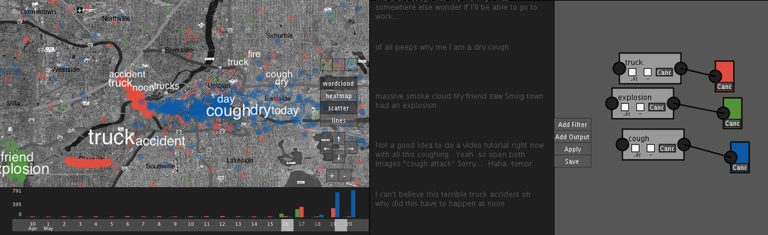
The above picture clearly shows that the airborne takes origins in downtown, next to the place where the truck accident happened. On the other hand, there is not a spatial relation between the Smogtown explosion and the people starting getting sick.
This simple justification can be strengthen with three more considerations:
This simple justification can be strengthen with three more considerations:
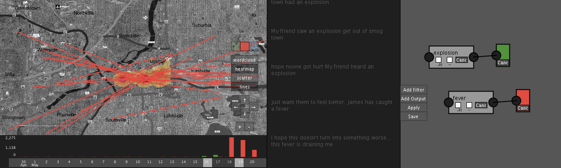
- The wind is directed from west to east, and in theory downtown could marginally be on the path of a so generated airborne. However, there is no trace of messages from sick people from somgtown to downtown, so the outbreak cannot be characterized in this way.
- Similarly, the river flows from north to south, so it could not carry spores to downtown. Furthermore there is no trace of messages from hill people from the explosion to downtown following the river, while there is in the opposite direction regarding the gastrointestinal outbreak.
- Last, as it is shown in the picture below, there is not a relevant path of sick people going from smogtown to downtown in that time interval. So we wouldn't go for a people-to-people outbreak
Why Not a bomb?
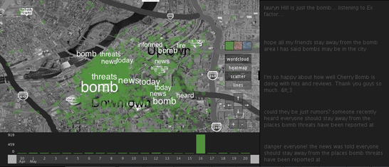
As the on-map tag cloud effectively shows, the bomb is only a rumor. There actually happened nothing related to an explosion of a bomb.
The words on the map and the side tweets contains references to threats,
Why not the airplane?
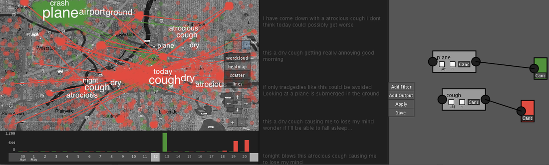
We found several tweets talking about a plane crash on May 13. These tweets are mostly concentrated near Plainville as visible in the figure below.
The same motivation for the explosion in smogtown are valid for the airplane. There are no clear paths which go from the crash to the center of the city where the outbreak takes place.
The figure below shows the paths of people moving from airport to downtown. Clearly there is not a lot of infected people coming from that direction.
The words on the map and the side tweets contains references to threats,
Why not the airplane?
We found several tweets talking about a plane crash on May 13. These tweets are mostly concentrated near Plainville as visible in the figure below.
The same motivation for the explosion in smogtown are valid for the airplane. There are no clear paths which go from the crash to the center of the city where the outbreak takes place.
The figure below shows the paths of people moving from airport to downtown. Clearly there is not a lot of infected people coming from that direction.